
NEW FEATURES / ENHANCEMENTS / UPDATES
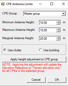
Minimum and Maximum height values
EDX Wireless is pleased to announce the introduction of a feature that allows precise control over minimum and maximum CPE height values for use in ‘Terrain + Building’ and ‘Terrain + Clutter’ scenarios. This functionality is particularly beneficial for optimizing Fixed Wireless Access (FWA) deployments and supporting Broadband Data Collection (BDC) filings.
- Height Range Definition: Users can now define minimum and maximum allowable height values for CPEs. When actual CPE heights fall outside this specified range, the tool will default to the defined limits for path loss calculations, ensuring consistent and reliable modeling.
- Additional Supporting Features:
- Unit Conversion: The feature includes the ability to switch units from meters to feet when English units are selected, enhancing flexibility for users in different regions.
- Marginal Antenna Height: A new option allows for the definition of a “Marginal Antenna Height,” ensuring that when antenna height exceeds the set maximum, the system will apply the maximum value for accurate modeling.
- Increased Precision: Antenna heights displayed in dialog boxes are now rendered with two significant digits, an improvement from the previous one-digit precision, allowing for more refined configuration.
- Additional Supporting Features:
- Application in ‘No Clutter’ Environments: This feature is fully functional even in areas classified as having ‘no clutter,’ further expanding its versatility across diverse planning scenarios.
Key Technical Enhancements:
This enhancement offers greater precision in path loss modeling and extends the flexibility of the tool to accommodate various wireless network design requirements.
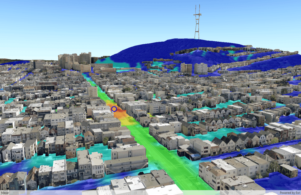
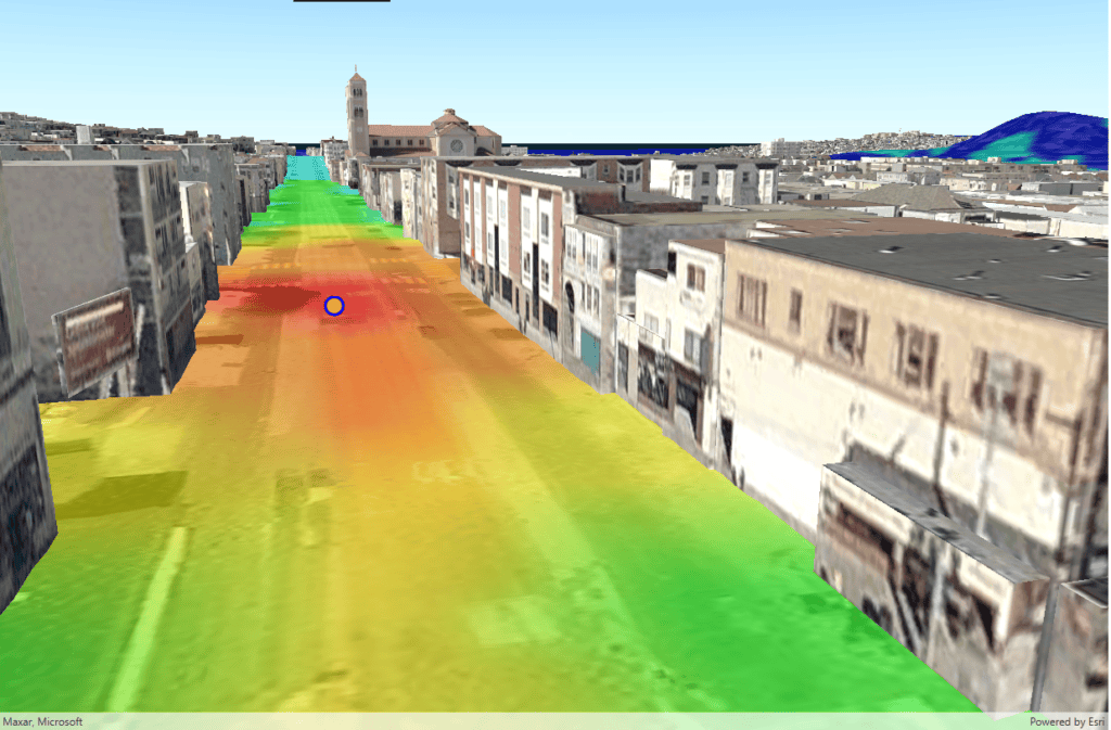
3D Environment Enhancement
- 3D Map Window Access: Users can now leverage advanced 3D mapping capabilities by accessing the 3D Map Window through their ESRI account.
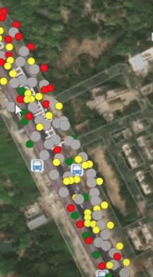
Crowdsourcing Data Integration for Enhanced Network Planning:
To further improve our customers’ network planning experience, we have introduced the ability to view crowdsourcing data directly within your network design.
Key Features:
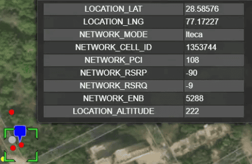
- Crowdsourced Data Insights: Users can now visualize valuable crowdsourcing data, including real-time user activity, coverage levels, and serving operator information. This data provides critical insights to help optimize network performance and coverage planning.
- Enhanced Network Design: By integrating this crowdsourced data into the network design process, planners can make more informed decisions, identifying areas of high demand, potential coverage gaps, and network performance bottlenecks based on actual user activity.
- Cloud Platform Integration: This feature is delivered through our cloud platform, enabling the processing and visualization of large datasets with seamless integration into your existing design workflows. The cloud-based approach ensures scalability and real-time data access without impacting local resources.
This new capability empowers users to leverage real-world data for more precise and dynamic network design, delivering a more optimized and efficient network infrastructure.
** Please note these features have been released under EAP, for access contact your account manager
BUG FIXES / OTHER
- Topology Report Error: The ticket was resolved by implementing a more efficient method for running topology reports on large projects, ensuring that the software could handle the complexity without errors
- Per sector study feature not displaying focus sector, IF the study has a label: The issue was resolved by modifying the software to handle labels with invalid characters, which are not allowed.
- Area study queries by point not working for per sector exports WHEN the study has a label: The problem was identified to be caused by certain invalid characters in the area study label, which are not allowed.
- Crash after try to open the maps layer: The crash was linked to a bug affecting the display of Multipoint Study layers; This is now resolved
- Warning with Area Study: The solution involved changes to support more area studies and extensive testing to ensure no adverse impacts.
- Crash when viewing map layers: Identified a bug causing crashes when the last Route study is deleted, affecting the display list and subsequent behavior. This is now resolved
- Crash during area study: Implemented a fix to prevent crashes when a polygon filter is checked with an invalid file and improved the GUI dialog to prevent bad filenames.
TRAINING & SUPPORT
Articles/Updates/Videos
- Live Coverage Contour
- Live Indoor Analysis
- Customer escalation path
Training
EDX Wireless is proud to announce new training offerings for our customers. The new trainings we offer are;
- SignalPro Beginners
- SignalPro Advanced
- Mesh Beginners
- Mesh Advanced
- LTE & LTE-Pro
- 5G Module
Please contact your account manager or EDX for more information