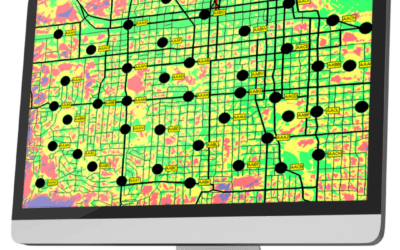
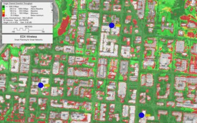
If you are working on a network with many sites and sectors, the process of running and querying area studies and checking coverage for each can be a time-consuming and frustrating process. The Per-Sector Studies feature of EDX SignalPro eliminates this by allowing you to run studies for any number of sectors at once, then displaying results for individual sectors.
With this feature, studies can be configured to run only on the sectors you chose and/or you may set up multiple map windows to compare study results and coverage of various sectors. If you have a meter file, this can be imported to determine the meters covered per sector. Per-Sector Studies support multiple area studies, allowing you to view and compare different studies among sectors without having to run multiple studies for each sector, saving you time and money.
Additionally, all results may be exported to .kmz in which you have the ability to check on and off the sectors you wish to view in Google Earth, providing you and your customers powerful visualization of system coverage on a per-sector basis.
Studies
As with any project in SignalPro, you may run as many area studies as you wish. The Per-Sector Study feature allows you to configure these studies to run for individual sectors alongside typical area studies. By setting the “focus sector,” users can display coverage per sector and set up multiple windows to compare different study results for that sector. The area study dialog now contains the ‘Run Per Sector’ box so you can see which studies are set for this feature.
Results
Using lat/longs, a database from the tower layer, imported .csv file or a meter file, you can query area study by points. The exported spreadsheet shows study results/values for every point from every sector. In addition, sectors can be exported to a .kmz file in either a consolidated file containing all sectors, or individual .kmz files for each. In a consolidated file, each sector becomes a layer in Google Earth that can be checked on/off, providing the ability to compare and visualize coverage between sectors.
Visualization
Sector results can be compared across multiple studies in the same project. Configure multiple windows and select a study for each by setting a ‘Focus’ sector. You can then view the results for each study for that sector. Engineers no longer have to run individual studies per sector one at a time, saving time and providing a powerful visualization of system performance.
Key use cases
- Large networks with many sites/sectors
- Smart Meter, Small Cell, IoT networks with many devices
- Sales presentations for complex systems
Download the Solution Brief Here:
Per-Sector Study Solution Brief
New to EDX?
EDX Wireless provides instant access to a full suite of network planning solutions. Our all-in-one cloud-based software provides instant access to all the tools needed for wireless design, maximizing productivity and providing first-rate service to your customers.
Our solutions ensure networks meet performance and cost requirements for 5G, LTE, IoT, mmWave, CBRS, Smart Grid, Distribution Automation, in-building DAS and more.


